August 27, 2013

Conquering Mauna Loa Summit...

Whew.  It's been a while since I last visited the blog-o-sphere.  As many of you know, I left Hawaii for Australia, but I have now landed back in the good ole' NKY.  The last 6 weeks have been a whirlwind.  But the blog isn't over.  I still have 5 or 6 Hawaii blog posts to do, and I've now been requested to do a few on my trip to Aussie land too.  So maybe I'll get around to that too.

In the world of my blog, I'm still backpacking around Volcano's national park on Hawai'i Island.
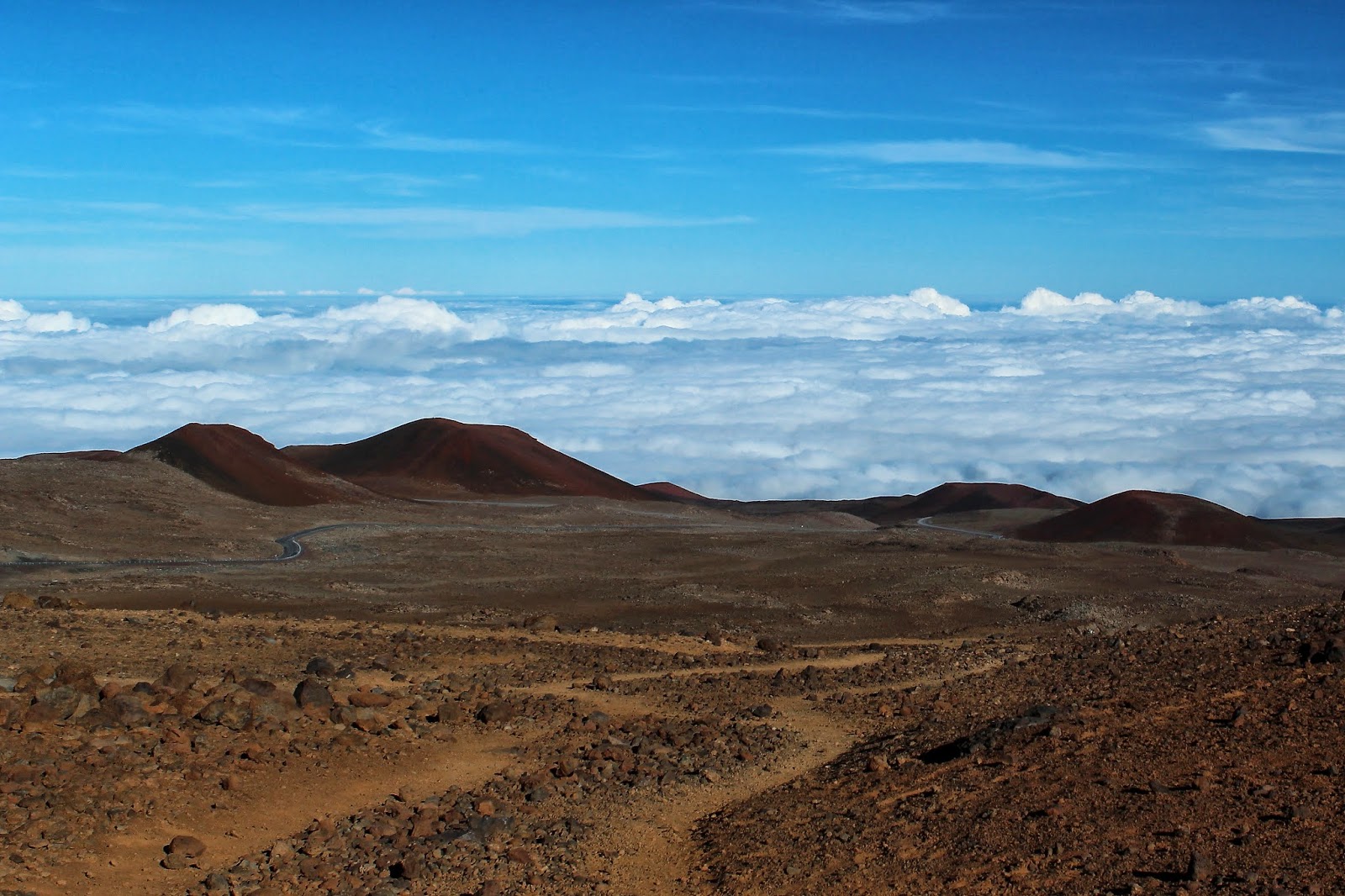
On the previous blog post, Conquering Mauna Kea Summit, I was atop the world's largest mountain (if you include the distance it rises from the sea floor).  Mauna Kea is almost 14,000 feet above sea level.  In this blog I'm hiking up Mauna Loa, which is only about 100 feet shorter than Mauna Kea.  In the picture to the right you can see where I camped prior to my hike up Mauna Loa.  The spot to park on the backside of the volcano is at 11,000 feet and I stayed there to get adjusted to the altitude.  I was joined by Matt and Ben, who were from England and California, respectively.  In the picture you can see Mauna Kea rising out of the clouds in the distance.

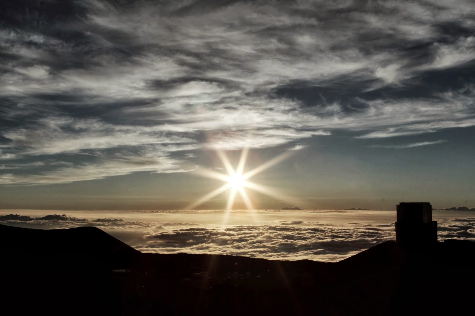
In the below picture, you can see Mauna Loa's only observatory in the upper left corner over my car.  I'm ready to go after packing up camp, so here's a pre-adventure picture.  Despite being 5-something in the morning, it's really bright, and it's also cold.  It was in the upper 30's/lower 40's at the start of my hike.  I'm probably smiling because the day is going according to plan, but that will soon change...


Sunrise at camp; 11,000 feet
The above picture shows the beautiful sunrise at 11,000 feet.  I only got about 4 hours of sleep before God turned the sun on, and I still had a mild headache from my prolonged time at altitude, but a silly little headache wasn't about to stop my 3,000 ft upward climb.

The picture below shows the surface I started walking on.  I found this huge drum in the middle of no where, which made for a good picture.  Hualalai lurks in the background, an 8,200 ft volcano.  It's actually really massive, but becomes dwarfed by its neighbors: Mauna Loa and Mauna Kea .


There was a 15-20% chance of severe hail and high altitude storms for the day.  The sky looks fine, but at 10,000+ feet the circumstances can change in an instance.  I had made the park rangers moderately annoyed since I was going by myself, and because I was trying to summit the volcano in one day from the North side.  I convinced them I could do it even though they said it's rare for people to accomplish it in one day (and they went on and on about some sort of safety concerns, blah, blah, blah...).  Typically people take a whole day to get up to the caldera's edge, then camp, and on the second day they summit and come back down.  I said, "ridiculous-ness" and professed my superior abilities to conquer this mountain.  They said they'd keep track of my progress by monitoring my car, which was their way of saying that if my car was still there more than 24 hours after my scheduled completion of the trail then they'd notify emergency services.  So my pack was filled with 5 L of water, 12 cliff bars, beef jerky, but mostly it held supplies for poor weather and/or emergencies.

I was grateful for my hood (for the unrelenting sun) and gloves (to battle the temperature).  ...and yes, this picture took multiple tries.
So I was supposed to be following Ahu for the trail, which is a fancy term for piled rocks, but I didn't see any so I just followed this little service trail.  I figured the trail would end where the Ahu started.  That makes sense, right?  Wrong!  Five minutes after I took the picture above, I realized I was completely lost when the trail just did a small loop back to itself.  Several concerns now surfaced: I was officially lost with no trail; I was 1.5 hours into the day with no time to spare; I'm on a dangerous hike.  Also, I had close to a zero chance of getting a cell phone signal for emergency help if I needed it.  

So back to the point of me being lost: I considered turning back and finding the trail, but I had probably missed it 1.5 hours earlier which would mean that I was then 3 hours short of the day.  I didn't have time for that if I was going to summit this volcano in a day, so I decided that realistically I can't be lost.  I knew the geographical direction of the trail compared to my supposed direction I had been traveling.  I mean, all I'm doing is climbing to the top of a Volcano, right?  There's only one direction to go to get to the top: up!  So, I figured I might as well just climb towards the summit.  So that's what I decided to do.  Since my visual points on the horizon were practically the same as when I started (ie. Hualalai and Mauna Kea) I was able to surmise my actual direction with my compass. my compass.  I was also confident that I could have easily made it back to camp at any point in time if the weather turned south once I was wondering the volcano's hillside without a trail.  So I decided to be a man and tell myself that I was obviously NOT lost...just making my own adventure.  Well, it made me feel better anyway.  In the back of my head was the ranger's warnings constantly on repeat, which suddenly seemed to make more sense...darn them for being right!

Two hours later I'm still climbing without a trail following a general compass direction toward the top, but I was also gradually crossing the mountain to where I figured the actual trial was.  I figured out why Mauna Loa means long mountain in Hawaiian, because you just keep climbing and you never see the top: going over top one ridge just allows you a view of another ridge a mile later.  I had my telephono lens on my camera so I could scan the distance frequently.  Altitude sickness always seemed to be just a moment away, and I was mildly concerned that if something happened the rangers wouldn't even be looking for me in the correct place since I was so far off course.  Oops - situations like this is probably why you are not supposed to hike dangerous areas alone.  After many Hail Mary's, Our Father's and possibly some bargaining with God on what I'd be willing to do in exchange for finding the trail safely, I  finally spotted a post about a mile away - it was a trail marker!  Whew.  Back on track!  Thanks Big Guy upstairs (oh, and You know I was just kidding about my willingness to be a priest when I was bargaining with You, right?).  I digress...


Now I could relax a little more.  I had been stopping every 100' or so earlier, not merely to scan the horizon, but also because of the altitude.  The air sure was thin.  Traveling over rough terrain with 35 pounds on my back at high altitude is a chore.  I found it difficult to stay positive at times.  I had to keep reminding myself that I do, in fact, run marathons, and that I was fine despite all the symptoms I was experiencing from mild altitude sickness.  I think the negativity was produced by the compounding of several symptoms I was experiencing: thin oxygen/shortness of breath, frequent pounding headache, racing heart rate, a heavy pack and the challenging terrain.  All of these were making me irritable and frustrated, plus the annoyance of being lost earlier (as I just listed all my symptoms it suddenly makes me wonder why I do crazy things such as this?).  I was back on track and I was trying to squash these negative attributes that were occurring.  Anytime I needed a break (which was often since I constantly felt like a fat man that had never run 10 ft in his entire life) all I had to do was turn around since Mauna Kea was always a beautiful site in the distance.  Mauna Kea was always visible since Mauna Loa is such a gradual slope and I was already above the tree line.  It was views like this that started to remind me the real reason I do this.  It's all a matter of perspective, which is a good phrase to remember about a lot of things in life.

Mauna Kea always watched my back.
Ah-ha! There's those darn Ahu I was supposed to be following! (picture below)


In the picture above, the trail finally started to flatten out, so I knew I had to be getting close.  I was now 7 hours in.  The above picture is one of my favorites.  Despite being volcanic rock from the same volcano, the various colors present in the rock were fascinating.  One side of the trail had extremely rough terrain with vibrant red colors in the rock, while the opposed side had fractured pure-black volcanic rock.  Meanwhile I was walking on, what appeared to be, gold colored flakes.  It was awesome.

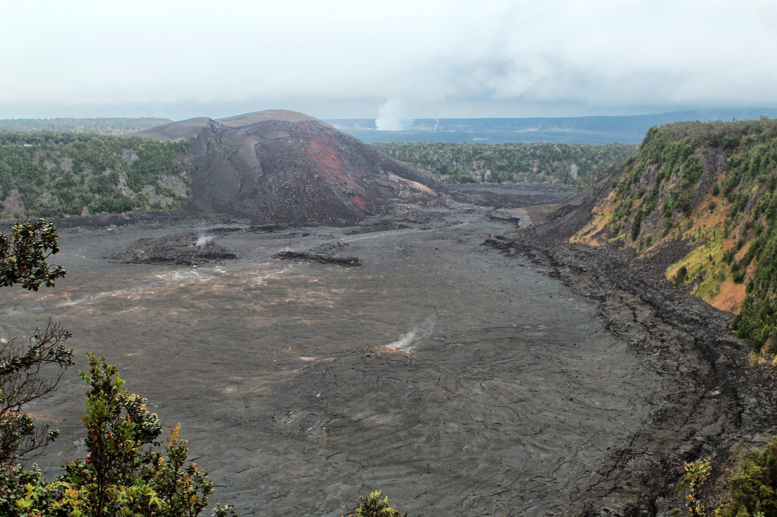
After 8 hours I finally made it to the edge of summit's caldera.  It was amazing.  So incredibly vast.  To get the entire caldera into one picture I had to take 4 pictures and then stitch them together.  It appeared as though the lava had just cooled days ago instead versus 30 years ago.  I can only imagine what it looked like as an actual lake of hot lava.  Fun facts (nerd alert): Mauna Loa last erupted in 1984 but it was a mild erruption.  The 1926 and 1950 eruptions were larger and each destroyed several villages.

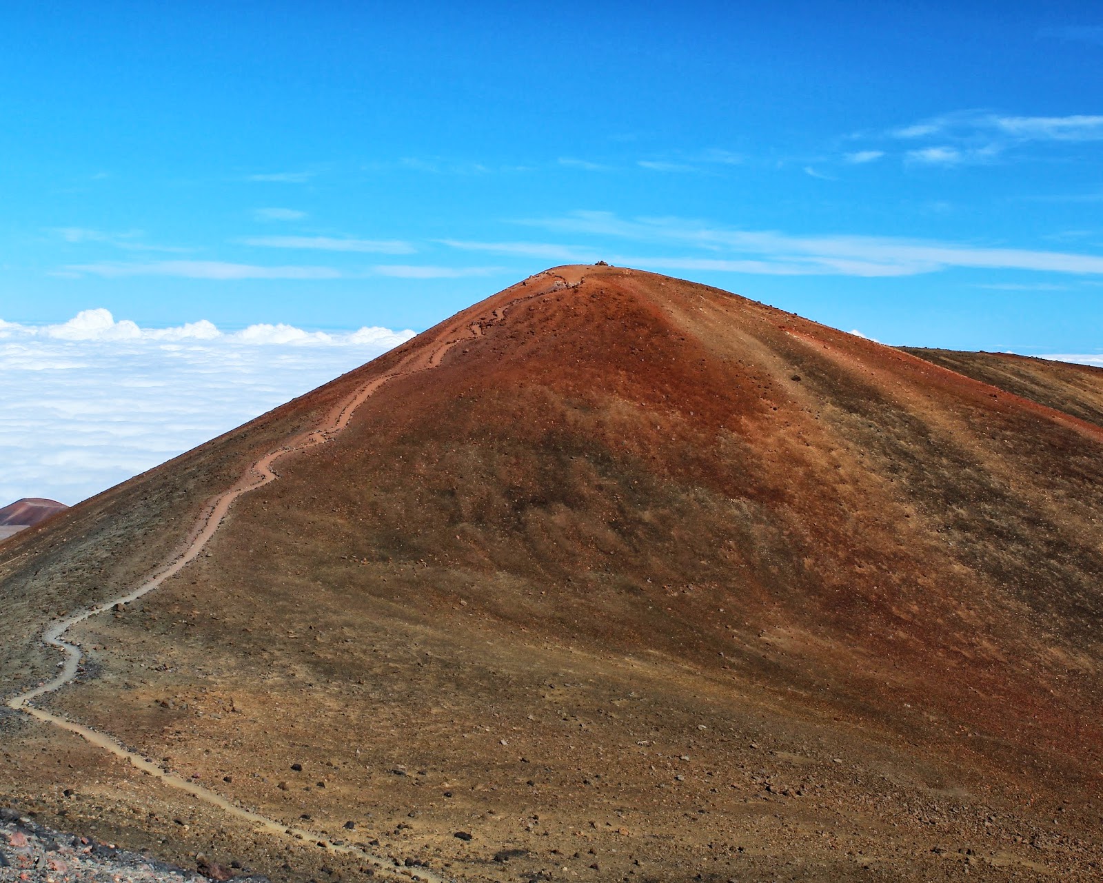
In the next two pictures you can see the cooled lava within the caldera.  You can also see the true summit of Mauna Loa a mile away in the distance.


The summit, in the above picture, was my true destination.  Despite being a mile away across the lava lake, it was still a 3.5 mile hike around the caldera's edge in order to get to the true summit, which was 300 ft higher than my current vantage point.  I was conflicted about the idea of continuing my journey to the summit, so I started the remaining hike around the edge while I thought about it.  Life was much better now since I was walking mostly on level ground so my headache and high heart rate had calmed quite a bit.  After a mile I noticed the clouds were becoming numerous in the area I had to hike back down, both low level and high level clouds.  In the picture below you can see that the clouds have formulated at 13,000+ ft instead of being at 8,000 ft where they were an hour ago.  Many were looking a bit ominous too.  I really didn't want to spend the night in a lava tube (cave) under severe weather conditions, so I decided to start my journey back to the base area.  Luckily, it was smooth sailing back down.  I was pleased to notice my headache disappear after 10 minutes, and a sub-max, but constant, pace kept my heart rate low.  All, I had to do was beat the weather.  On the way back down I did have some mild rain and intermittent high gusts of winds, but overall it was fine.  Sure enough those piles of rocks led me all the way back to my car!  Turns out, I literally missed them within the first 5 minutes of the start of my hike earlier in the day.


Lava tube/cave

Mahalo for visiting.  A hui hou.

*Sorry if some of the pictures are a bit too grainy.  I typically decrease the quality of the pictures to help with uploading them, but this time I think I decreased the quality too much in some of them.

July 10, 2013

Conquering Mauna Kea Volcano Summit...

I've been to Mauna Kea Volcano before (see this post), but last time I only made it to 9,000 feet.  On my return trip to Hawaii Island, I was determined to adventure to the top.  I wanted to hike the summit, see the observatories, and watch the sunset above the clouds.  I was on a mission:  I planed to hitch hike my way up the road after 9,000 feet (don't worry Dad, I would have been fine), but the rental car company upgraded me to a 4-wheel drive (sometimes it does pay to be a 'local' in tourist-country).  I think all the rental companies have rules about not taking the cars off roads, but rules are more 'guidelines' when shenanigans are to be had, right?  In this case I was definitely adopting the theory of begging forgiveness instead of asking permission.  So on up the mountain I went!

Mauna Kea is almost 14,000 feet above sea level, but if measured from it's true base on the Pacific Ocean floor it would be 33,500 ft tall, making it the tallest mountain on Earth (Mount Everest is 29,000 ft and K2 is 28,000).

I stopped at 9,000 for 30 minutes to adjust better to the altitude.  While there I visited the Mauna Kea Silversword sanctuary.  The M.K. Silversword is an endangered and endemic plant species.  It lives approximately 40 years.  It spontaneously dies after it flowers.  All it will ever produce will be one flower during it's final hurrah, and then it whole life comes to an end.  A silversword is rare enough, but a flowering silversword is even more rare.  When Silverswords do flower, professional photographers tend to flock to the site for the rare opportunity to capture it during it's brief moment of fame.  


Then I headed to the top.  It was quite a long and bumpy ride but I was awarded with a constant view of the observatories above cloud level.


One of the rangers told me about a great hike that was only 1.5 miles to a lake, near the summit.  That sounded like an easy hike, until I realized how hiking at elevation would effect me.  Let's just say I took a lot of breaks during that 1.5 mile hike.  But it was worth it, the lake was beautiful with the strangest surroundings.


I love the reflection off the water.  I see some cloud, blue sky and then for some reason the volcanic rock reflects green.

More observatories near the summit of Mauna Kea
Once I got back to my car (from the longest 1.5 mile hike in my life!), I headed for the summit.  If I was going to be this close to the tallest mountain in the world then conquering the summit is a must, right?!

There's the summit shining it all it's glory:

Mauna Kea Summit
Hawaii Topher on Mauna Kea's summit.  ...whew the air is thin up here!  ...and its cold too.
I flew into Hilo Airport earlier that morning.  Driving up the volcano and trekking two small hikes took the entire day.  It was time to watch the sunset, and it really was one of the best sunsets I've ever seen.  The color in the sky when you are up that high, above the clouds, was amazing.

I dropped the saturation in this picture.  Taking it all the way to B/W took too much out of the picture so I left soft tones in.

Almost ducking under the clouds.

The clouds are held at a certain level by the volcanos massive height, but here I caught some clouds (lower left of picture below) crawling around the volcano's side on their way to meet the other lower cloud line.  The clouds in the lower left are actually sandwiched between Mauna Kea and Mauna Loa.  Mauna Loa is the other volcano next to Mauna Kea and just a glimpse can be seen in the picture below on the far side of the clouds on the lower left.

Once I was finished I drove back down to 9,000 ft for dinner.  I had to get ready to head to my trip's first campsite on the adjacent volcano: Mauna Loa.  I planned to camp Mauna Loa's lone observatory at 11,000 feet in order to further adjust to altitude and prepare for a grueling hike up Mauna Loa which is only accessible by foot.  Mauna Loa, is just shy of Mauna Kea's height (almost 14,000 feet).  As I was driving down Mauna Kea, I spotted a red dot on the volcano far away which is a red light fixed to the top of Mauna Loa's observatory.  To the red dot I go!  I'll let you know how my time on Mauna Loa went in my next blog.

Mahalo for visiting.  A hui hou!

June 17, 2013

Kilauea's Volcanic Eruptions...

This blog starts a series of volcano posts.  I have visited Hawai'i Island a couple times now (ie. the Big Island), and it is my favorite island.  There are five volcanos on Hawai'i Island: Mauna Loa, Mauna Kea, Kilauea, Hualalai, Lohala.  I have backpacked and summited the first three.  My favorite place on the island is Volcanos National Forest, part of the U.S. National Park System.  Volcanos National Forest is primarily composed of Kilauea Volcano.  Kilauea is frequently active, and 90% of its surface is less than 1,000 years old; young in volcano standards.  Presently, it has been erupting continuously since January of 1983.

Kilauea Caldera, situated at the top of the volcano, 4000 feet above sea level, is the most visited place in Volcanos National Park.  It is drive-able with a great visitor center, museum, and has a relatively low altitude (unlike Mauna Loa and Mauna Kea with elevate to approximately 14,000 feet).  Inside Kilauea's caldera is Halema'uma'u Crater.  This basically creates a crater in a crater.  To give you an appreciation of size when looking at the pictures: Kilauea Caldera's diameter ranges between 2 and 3 miles while Halema'uma'u's crater is approximately 3,000 feet (over half a mile) wide.  Halema'uma'u has a lava lake which spits up lava and sends a constant plume of volcanic gas into the air visible 10's of miles away.

Kilauea Caldera's beauty is indescribable.   I've visited 20+ times during my visits to Hawai'i Island, each time with a different experience and perspective.  It changes appearance based on times of day and the widely fluctuating weather conditions.  The best times are at night, but it frequently rains then, causing difficult viewing.  Dawn and dusk can be pretty awesome as well, while day time gives you a true appreciation of the surrounding landscape's size.  There's also plenty of time where the views been completely obscured due to thick fog/clouds/rain/etc...

I have hundreds of pictures of Kilauea; mostly of Halema'uma'u Crater.  I chose a few pictures below to share different view points.  Day, night, dusk, dawn, raining, cloudy, clear, 'voggy' are all represented below.  I'll put the time of day and directional view point in the caption.  Volcanos National Park should be on everyone's must-see list.  Like I said above: it's indescribable so I won't even try since I won't be able to do it justice.  Maybe the pictures below will help, but the word majestic seems to be the most accurate way to describe it.  Not only is it one of my favorite places on my favorite Hawaiian island, but it's probably the most fascinating thing I have ever seen.

Mahalo for visiting and mahalo for reading my above rant regarding the awesomeness of this place.  Enjoy the pictures and let me know what you think.  A hui hou!

Halema'uma'u Crater: mild rain, nighttime, Jagger Museum viewing area (Northwest of crater)
Halema'uma'u Crater: Just after sunrise, Jagger Museum viewing area (Northwest of crater).  The entire area around crater and extending far out of the picture is Kilauea Caldera.
Volcanic gas plume.  Mid-day.  Viewed from 7,000 foot elevation while on the side of Mauna Loa Volcano
Maybe my best photographic moment to date: Halema'uma'u Crater: Very early dawn (long exposure), Jagger Museum viewing area (Northwest of crater)
Halema'uma'u Crater: Late dawn, Jagger Museum viewing area (Northwest of crater)
The walls of Kilauea Caldera can be seen on the far right.  Viewpoint of Halemu'uma'u Crater from the North, 2 miles away.
Foreground is the Southeastern edge of Kilauea Caldera.  Mid day, obviously.
Halema'uma'u Crater at nighttime from the Eastern rim of Kilauea Caldera.
It was cloudy but clear below the clouds...wow, those clouds look angry.
Halema'uma'u Crater.  Cloudy at early dusk (long exposure).  Viewpoint from Jagger Museum (Northwest of crater), but unlike pictures from the same vantage point above, the winds are blowing the opposite way this particular day.
Halema'uma'u Crater during a cloudy dusk.  Viewpoint from Jagger Museum (Northwest of crater)
Kilauea and Halema'uma'u in the far distance, viewed from East at the rim of Kilauea Iki (the crater in this picture).  It is cloudy, but the land in the furthest distance in his picture is Mauna Loa Volcano.  It rises up through the clouds on the right side of the photo.
Halema'uma'u Crater.  Cloudy but just after sunrise.  Viewpoint from Jagger Museum (Northwest of crater)